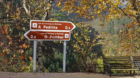


The local council has strengthened the signposting of its five most attractive waterfalls
16 dic 2025 . Actualizado a las 17:38 h.The Quiroga Town Council has just installed new tourist signage along the so-called Ruta das Fervenzas (Waterfalls Route), which runs past five waterfalls in the municipality noted for their accessibility and spectacular scenery. The installation of the signs has been carried out with the support of the sustainability plan of the Ribeira Sacra Tourism Consortium.
Through its social media channels, the Montañas do Courel Geopark recommends taking advantage of the autumn season to walk the route —as the waterfalls are more impressive at this time of year— although it stresses that this should always be done “with great caution”.
The 25-kilometre route runs between the municipal capital and the village of Vieiros along the LU-P-5001 and LU-P-5004 roads. The new signs have been placed at junctions in the localities of Vilaverde —where two signs were installed— Cruz de Outeiro —another two— and Barreiro. The Quiroga Town Council points out that the paths leading to the waterfalls from these roads had already been signposted previously. The route, moreover, is marked on Google Maps.
The waterfalls that make up the route are detailed below:
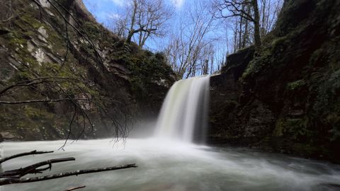
O Pombar. Also known as A Ola, it is located on the Quiroga River, near the village of Cruz de Outeiro. The waterfall drops about twelve metres into a deep and wide pool. From the point where vehicles are left on the road, visitors must walk along a path of around one kilometre to reach the site.
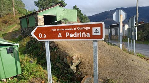
A Pedriña. Also located on the Quiroga River and near Cruz de Outeiro, it falls from a height of about fifteen metres into a deep pool. To reach this spot, visitors must leave their car at a point on the road linking Cruz de Outeiro with Vilarbacú and walk along a trail approximately six hundred metres long.
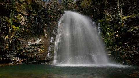
As Gurbias. This waterfall is located on the Selmo River within the village of A Seara. The water cascades down in steps, overcoming a drop of around twenty-five metres, and ends in a shallow pool.
O Fócaro. It is located 200 metres from the aforementioned village of A Seara, in the direction of the Lucenza glacial lagoon. It takes its name from a stream that is one of the first tributaries of the Selmo River. Here, the water falls from a height of more than twenty-five metres into a shallow pool. According to the Town Council, this is the waterfall most affected by low water levels during the dry season.
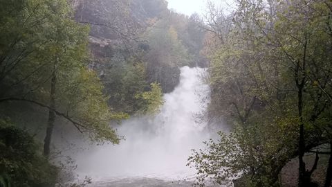
Vieiros. Located in the village of the same name, it is also part of the Selmo River, whose waters fall here from a height of around 35 metres. A short route allows visitors to view it from the top. According to a study carried out last year by researchers from the University of Vigo, this site is the most popular in the entire Montañas do Courel Geopark among users of the Google Maps platform.